Satellite Map: photograph of Earth made by means of artificial satellites.
Political Map: a map that includes a country's boundaries, territories, and capital.
Isopleth: a line or curve connecting points of equal value.
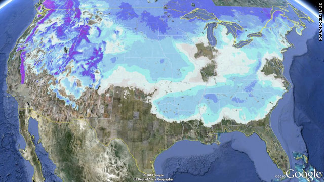
This map shows the snow present in 49 of the 50 states on January 11, 2011. The base of the map is a satellite photo of the United States, with the political boundaries of the country and its states added on top. Isopleths show the distribution of snow, and the spaces in between isopleths were filled in with colors to show the depth of the snow. Although not specifically labeled on the map, it can be inferred that the deeper colors show where the deepest snow is. Florida was the only state that did not have any snow, although, as can be seen from the map, it came inching very close to the border of Florida and Georgia.