Bathymetric Map- a map of the sea-bed surface showing depths below sea level.
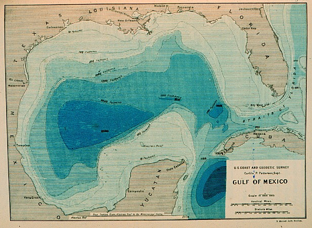
Bathymetric maps are similar to surface topography maps. This map shows the first realistic bathymetric map of any ocean basin, created between 1873 and 1875 in the Gulf of Mexico.
No comments:
Post a Comment