Isopach- a line on a map connecting points of equal thickness in a stratigraphic layer. Used to indicate rock thickness.
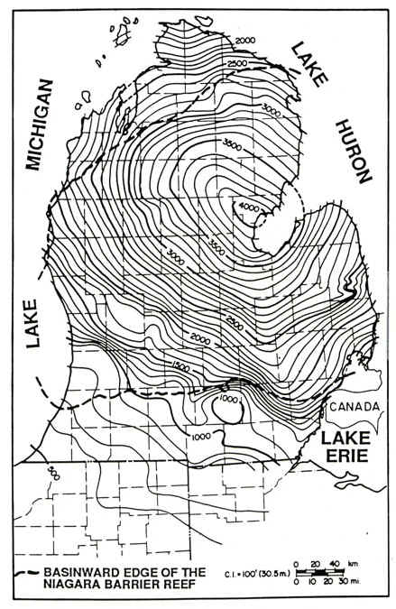
Isopach maps are used in stratigraphy, sedimentology, structural geology, petroleum geology, and volcanology. Connected lines indicate points of equal thickness, similar to isobars or isotachs. This map shows Michigan in a stage of rock development. The thickest rocks occur at the bay where the 4000 is located, and the thinnest rocks occur at the southernmost edge of the state. This map is from the Silurian period of sedimentary rock development.
No comments:
Post a Comment